
 Scan With Phone's Bar Code Reader

| Countdown to Fall | ||
|
| Updated: @ 1/1/1970 @ 1:00am | |||||||||||||||||||||||||||||||||||||||||||||||||||||||||||
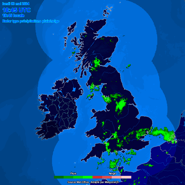
| Summary / Temperature / Radar | Wind | Rain | Outlook | ||||||||||||||||||||||||||||||||||||||||||||||||||||||||
|
|
|
|
||||||||||||||||||||||||||||||||||||||||||||||||||||||||
| Humidity & Barometer | Almanac | Fire / Air Quality | |||||||||||||||||||||||||||||||||||||||||||||||||||||||||
|
|
|
|||||||||||||||||||||||||||||||||||||||||||||||||||||||||
| UV Index | Solar Radiation | ||||||||||||||||||||||||||||||||||||||||||||||||||||||||||
|
 |
||||||||||||||||||||||||||||||||||||||||||||||||||||||||||


| WXSIM Tamworth Weather Forecast - Outlook: Tonight & Monday | ||||||
|
||||||

| WXSIM Tamworth Short Term Weather Forecast |